Original Story
The Most Advanced Underwater Robot Ever Used in the Search Is About to Map Loch Ness
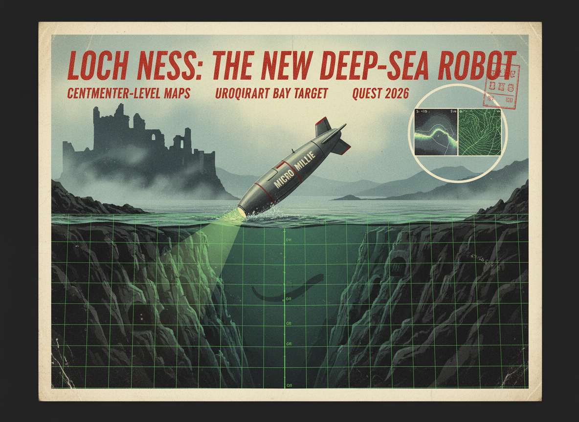
A marine exploration company that previously hunted the Titanic is bringing its Micro Millie autonomous underwater vehicle to Loch Ness for The Quest 2026, happening May 28 to May 30. This is the most technically sophisticated Nessie search in the loch’s history, and for the first time, the floor of Urquhart Bay, the most active area for sightings, will be mapped at centimeter-level resolution.
The search for the Loch Ness Monster has been going on since 1933. That is when the first modern sighting made headlines and transformed a quiet Scottish lake into one of the most talked-about bodies of water on Earth.
Since then, researchers have used boats, nets, sonar, underwater cameras, hydrophones, thermal drones, eDNA sampling, and even submarines. None of them have found definitive proof of anything large and unexplained living in the loch.
In May 2026, the search is getting its most powerful tool yet.
Deep Sea Vision, the marine exploration company that made headlines in 2024 for finding a long-lost World War II aircraft carrier and has tracked other historically significant wrecks around the world, is bringing its Micro Millie autonomous underwater vehicle to Loch Ness for the annual Nessie search event called The Quest 2026. The event runs from Thursday, May 28 to Sunday, May 30, hosted by the Loch Ness Centre in Drumnadrochit.
This is not a publicity stunt. The technology involved is the same technology used to find objects sitting in the deepest, darkest parts of the ocean.
What Makes Micro Millie Different
To understand why this matters, you need to know how limited previous Loch Ness searches have been.
Most maps of the loch floor were made using sonar systems that create images at a resolution of about 5 to 10 meters. That sounds precise, but it means anything smaller than a mid-sized vehicle would not show up at all. Caves, openings in the rocky walls of the loch, and any features smaller than a few meters are essentially invisible at that resolution.
Micro Millie maps the seafloor at centimeter-level resolution. That is the difference between a blurry satellite photo where you can barely make out a building and a photo detailed enough to read a street sign.
The vehicle is a compact autonomous underwater drone, torpedo-shaped, designed to navigate challenging environments without a human pilot. It carries cameras and sonar systems capable of producing high-resolution 3D maps of the bottom. In the ocean, it has been used to identify specific wreck features and small objects on the seabed at significant depths.
Loch Ness presents its own unique challenges. The water is dark and filled with peat particles that reduce visibility to almost nothing. The loch is deep, reaching 226 meters at its deepest point, making it the largest body of freshwater in the United Kingdom by volume. The sides of the loch drop almost vertically, like an underwater canyon, which creates difficult acoustic conditions for sonar. Craig Wallace, president of operations at Deep Sea Vision, acknowledged this directly: “Loch Ness is a unique and challenging environment.”
The target for this first deployment is Urquhart Bay, a section of the loch that sits below the ruins of Urquhart Castle on the western shore. It is the area with the highest concentration of Nessie sighting reports over the past several decades, and it has never been mapped at high resolution.
Why Urquhart Bay
People do not randomly pick the bay below Urquhart Castle for their sightings. The official Loch Ness Monster Sightings Register, maintained by Gary Campbell, shows a consistent cluster of reports in that area. The castle itself was built on a promontory jutting into the loch, which creates a natural visual vantage point. Visitors to the castle have one of the best unobstructed views of the open water. When something large surfaces, that is where people tend to see it.
The bay is also where historical sonar contacts have been logged. In the 1960s and again in the 1990s, sonar equipment deployed in Loch Ness picked up large, strong underwater contacts that were described at the time as too large to be explained by the known fish population of the loch. Some of those contacts were in the bay or nearby.
The current mapping focus on Urquhart Bay is deliberate. Deep Sea Vision and the Loch Ness Centre want to understand the detailed topography of the most active area before expanding coverage elsewhere.
What the High-Resolution Mapping Could Find
The main goal of this mission is stated clearly as mapping and scientific understanding of the loch bed. Organizers are not promising to find Nessie. But the mapping could reveal things that matter to the search regardless.
At centimeter-level resolution, the survey will be able to identify caves or openings in the underwater cliff faces that line the loch. This is significant because one of the persistent questions about any large creature living in Loch Ness is where it rests and hides. The loch is heavily trafficked by boats, and the surface is visually monitored by webcams for significant portions of the day. If something large lives in the loch and rarely shows itself, it needs somewhere to go. Underwater caves or openings in the vertical rock walls of the loch’s sides have long been theorized as possible shelter zones. No survey has ever had the resolution to confirm whether those features exist.
The mapping will also establish a detailed baseline for the loch floor in the bay. If future surveys find anything different, relocated, or otherwise unusual, they will have something precise to compare it to.
The Quest 2026
The event itself, running May 28 to 30, is the fourth annual Quest organized by the Loch Ness Centre and the volunteer research group Loch Ness Exploration. Previous years have used thermal-imaging drones, hydrophones, eDNA collection, and surface observation cameras. The event draws researchers, enthusiasts, and the just-curious from around the world.
Deep Sea Vision’s involvement marks the first time a company with deep-sea wreck-hunting credentials has joined the event. The same technology used to find historically significant ships on the ocean floor is now being pointed at the floor of a Scottish lake.
As for what Micro Millie will actually find down there, Craig Wallace offered the only honest answer: “This initial mission will help define future survey strategies and represents a significant step forward in efforts to better understand the structure and composition of one of Scotland’s most studied, yet still largely unexplored, bodies of water.”
The most sophisticated search in the 93-year history of the Loch Ness Monster legend begins at the end of May. Whatever is or is not in that water, we are about to know more about the lake itself than we ever have.
Sources: Inverness Courier, The Loch Ness Experience Teams Up with Marine Exploration Company Deep Sea Vision, Coast to Coast AM via iHeart, Marine Exploration Company to Participate in Loch Ness Search Event, Official Loch Ness Monster Sightings Register, lochnesssightings.com

Scientists Just Published a Formal Warning: AI Could Start Evolving on Its Own. Darwinian Selection Would Make It Impossible to Control.
A paper published April 20, 2026, in PNAS — the Proceedings of the National Academy of Sciences, one of the most prestigious…

The CIA Used Vampire Folklore to Win a War. Here Is Exactly How They Did It.
In 1950, a former advertising man named Edward Lansdale arrived in the Philippines as a US Air Force colonel and CIA operative,…
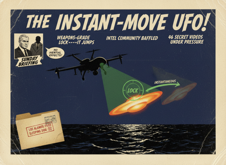
Jeremy Corbell Told Fox News That UAP Can Move Instantaneously. He Says the Intelligence Community Is Baffled.
On Sunday, May 3, 2026, investigative journalist Jeremy Corbell appeared on Fox News' Sunday Briefing and made a series of specific and…

NASA Has Mapped the Water in the Galaxy. The Ocean Beneath Your Feet Came From Out There.
A study published in The Astrophysical Journal on April 15, 2026, based on data from NASA's SPHEREx mission, has produced the first…